
Hobson’s Holler Guidebook
Canoeing & Floating
The timeless rhythm of moving water touches something in all of us. The Current and Jacks Fork rivers remain almost as wild and natural as the day Indians lightly trod the Ozark trails. We invite you to experience these magnificent Ozark National Scenic Riverways with us. Our facilities include canoes, tubes, camping, cabins, pool, dining, general store, hot showers, modern restrooms and electric hook-ups.
Akers Ferry Canoe Rental
36869 State Rte K
Boiling Springs Resort
15750 State Rte BB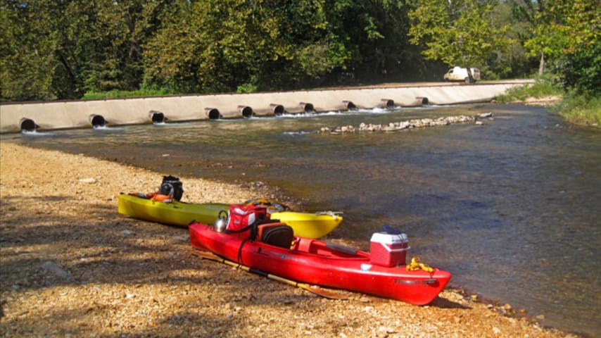
Cedar Grove Canoe Access
Current River
Jacks Fork
Jadwin Canoe Rental
8754 State Hwy KATV & Swimming Hole
Flat Nasty Offraod Park
1775 Hwy ZzPublic Hunting
Missouri offers some of the best public hunting and fishing access in the Midwest. From large timbered tracts to smaller river access locations, the Show Me State has plenty to offer. Mark Twain National Forest
• 1.5 million acres
• Excellent deer and turkey hunting
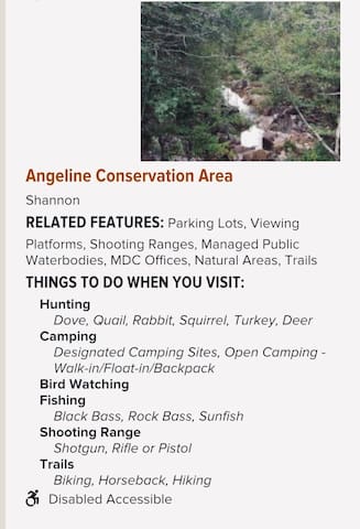
Angeline Hollow
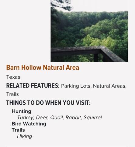
Barn Hollow Natural Area
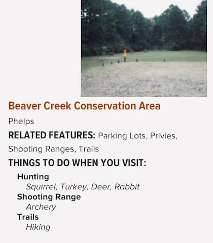
Beaver Creek
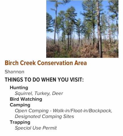
Birch Creek
Mark Twain National Forest (MTNF) is a U.S. National Forest located in the southern half of Missouri. MTNF was established on September 11, 1939. It is named for author Mark Twain, a Missouri native. The MTNF covers 3,068,800 acres of which 1,506,100 acres is public owned, 78,000 acres of which are Wilderness, and National Scenic River area. MTNF spans 29 counties and represents 11% of all forested land in Missouri. MTNF is divided into six distinct ranger districts: Ava-Cassville-Willow Springs, Eleven Point, Houston-Rolla, Cedar Creek, Poplar Bluff, Potosi-Fredericktown, and the Salem. The six ranger districts actually comprise nine overall unique tracts of forests. Its headquarters are in Rolla, Missouri.
Some unique features of the Mark Twain include Greer Spring, which is the largest spring on National Forest land and part of the Eleven Point National Scenic River, and pumps an average of 214 million gallons of water per day into the river. The public can also visit the Glade Top Trail National Scenic Byway, which offers views of over 30 miles (48 km) to the Boston Mountains in Arkansas. The 350-mile Ozark Trail system winds through much of the National Forest.
Although it is far from being the largest National Forest in acreage, Mark Twain National Forest is located in more counties than any other. As of September 30, 2007, its 1,490,862 acres (2,329.472 sq mi) were spread over parts of 29 counties in southern and central Missouri
11 người dân địa phương đề xuất
Mark Twain National Forest
401 Fairgrounds RdMark Twain National Forest (MTNF) is a U.S. National Forest located in the southern half of Missouri. MTNF was established on September 11, 1939. It is named for author Mark Twain, a Missouri native. The MTNF covers 3,068,800 acres of which 1,506,100 acres is public owned, 78,000 acres of which are Wilderness, and National Scenic River area. MTNF spans 29 counties and represents 11% of all forested land in Missouri. MTNF is divided into six distinct ranger districts: Ava-Cassville-Willow Springs, Eleven Point, Houston-Rolla, Cedar Creek, Poplar Bluff, Potosi-Fredericktown, and the Salem. The six ranger districts actually comprise nine overall unique tracts of forests. Its headquarters are in Rolla, Missouri.
Some unique features of the Mark Twain include Greer Spring, which is the largest spring on National Forest land and part of the Eleven Point National Scenic River, and pumps an average of 214 million gallons of water per day into the river. The public can also visit the Glade Top Trail National Scenic Byway, which offers views of over 30 miles (48 km) to the Boston Mountains in Arkansas. The 350-mile Ozark Trail system winds through much of the National Forest.
Although it is far from being the largest National Forest in acreage, Mark Twain National Forest is located in more counties than any other. As of September 30, 2007, its 1,490,862 acres (2,329.472 sq mi) were spread over parts of 29 counties in southern and central Missouri
Nearby Colleges & Universities
Centrally located for family and friends to visit affordability when your college student has special occasions. i.e. Family Week, Registration days
Missouri University of Science and Technology
300 W 13th StMissouri State University-West Plains
2715 128 Garfield AveMissouri State University
901 S National AveOzarks Technical Community College
1001 E Chestnut ExpySouthwest Baptist University - Salem Campus
501 S Grand AveFood scene
Town & Country Supermarket
117 MO-32Casey's
800 E Scenic Rivers BlvdRoute 63 Liquor
102 Industrial StEl Carnaval Mexican Restaurant LLC
127 MO-32Hood's Frosty Treat
202 N Main StP J's Cafe
142 MO-32Sonic Drive-In
500 MO-32Subway
1134 S Main StWalmart Supercenter
1101 MO-32Medical Facilities
Nearby Medical Facilities with 24 hour emergency and ambulance care
Phelps Health Medical Group
1000 W 10th StSalem Memorial District Hospital
P.O. Box 774
35629 Highway 72
Salem, Missouri 65560
PH: 573-729-6626

Salem Memorial District Hospital
35629 Missouri 72Salem Memorial District Hospital
P.O. Box 774
35629 Highway 72
Salem, Missouri 65560
PH: 573-729-6626
Texas County Memorial Hospital
1333 S Sam Houston Blvd1333 S Sam Houston Blvd
Houston, MO 65483
United States