
Some of our favourite walks
Favourite Walking Routes
Rowans Cottage is a North York Moors "Walking Friendly" accommodation provider. We offer facilities such as boot cleaning, kit storage and drying facilities. We can help with advice on the nearest outdoor shops and can recommend activity providers. In the cottage we have maps and guide books to borrow. This guidebook suggests some of our favourite routes with Walking Friendly places to eat for that all important lunch stop.
For lots more suggestions please visit:
https://www.northyorkmoors.org.uk/visiting/enjoy-outdoors/walking
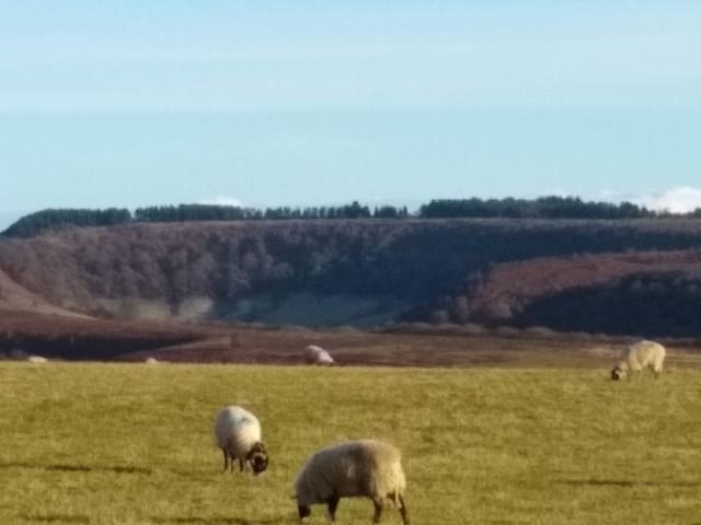
The famous Hole of Horcum is a giant natural amphitheatre carved out of Levisham Moor. The hollow is 400 feet deep and stretches 3/4 of a mile across. A "Devil's Punchbowl" type feature, local legend states that the amphitheatre was formed when Wade the Giant scooped up a handful of earth to throw at his wife during an argument.
Amazing views at this geological wonder, a half day walking loop from the cottage.
Directions in the guide books and on the OS map provided in the cottage.
19 người dân địa phương đề xuất
Hole of Horcum
The famous Hole of Horcum is a giant natural amphitheatre carved out of Levisham Moor. The hollow is 400 feet deep and stretches 3/4 of a mile across. A "Devil's Punchbowl" type feature, local legend states that the amphitheatre was formed when Wade the Giant scooped up a handful of earth to throw at his wife during an argument.
Amazing views at this geological wonder, a half day walking loop from the cottage.
Directions in the guide books and on the OS map provided in the cottage.
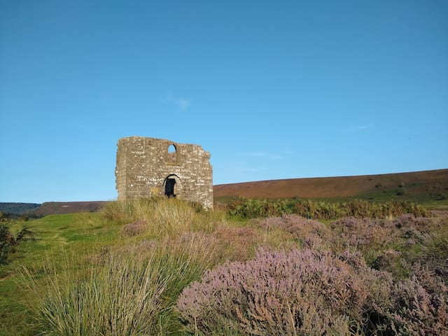
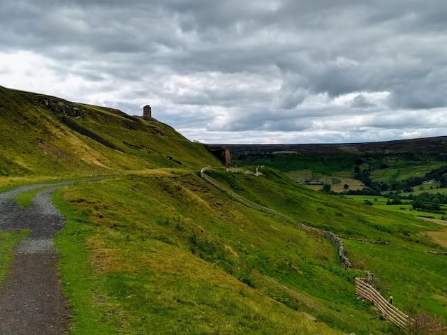
The ruined folly of Skelton Tower, an important local landmark and a Grade II listed building, was constructed around 1830 as a shooting lodge by the Rev. Robert Skelton, a former rector of Levisham.
Beautiful views across the moors and along the route of the North Yorkshire Moors Railway. Not too taxing a walk, with the option of refreshments if starting and finishing at the Horeshoe Inn at Levisham.
Directions in the guide books and on the OS map provided in the cottage.
Skelton Tower
The ruined folly of Skelton Tower, an important local landmark and a Grade II listed building, was constructed around 1830 as a shooting lodge by the Rev. Robert Skelton, a former rector of Levisham.
Beautiful views across the moors and along the route of the North Yorkshire Moors Railway. Not too taxing a walk, with the option of refreshments if starting and finishing at the Horeshoe Inn at Levisham.
Directions in the guide books and on the OS map provided in the cottage.
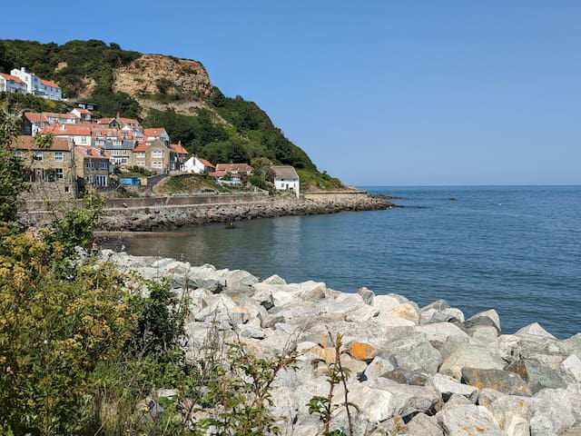
Beautiful long sandy beach with great fossil hunting. Park at the top car park.
If you're feeling energetic walk the old railway line to Kettleness and return via the Cleveland Way.
Directions in the guide books and on the OS map provided in the cottage.
72 người dân địa phương đề xuất
Runswick Bay
Beautiful long sandy beach with great fossil hunting. Park at the top car park.
If you're feeling energetic walk the old railway line to Kettleness and return via the Cleveland Way.
Directions in the guide books and on the OS map provided in the cottage.
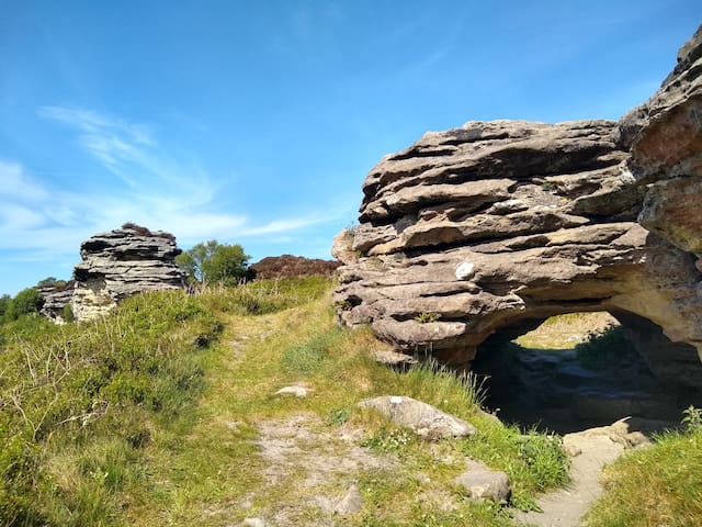
Aptly named ‘Brink-stones’ or edge stones in Old Norse, you can follow footpaths to the top to experience the Bridestones first hand. These fascinating rocks are the remains of a sandstone ‘cap’ that was originally much higher, Jurassic sedimentary rock deposited some 150 million years ago.
Layers of hard sandstone alternating with softer calcareous layers have been eroded by wind, frost and rain over thousands of years. The result is the strange and wonderful shapes left today. They make the perfect place to picnic or to sit and absorb panoramic views.
Walk from the cottage or park at the Saltersgate car park and set off in a direction away from most others to reach Blakey Topping and onto the Bridestones!
Go in the late afternoon and evening to the Bridestones to avoid peak time.
Directions in the guide books and on the OS map provided in the cottage.
National Trust - Bridestones, Crosscliff & Blakey Topping
StaindaleAptly named ‘Brink-stones’ or edge stones in Old Norse, you can follow footpaths to the top to experience the Bridestones first hand. These fascinating rocks are the remains of a sandstone ‘cap’ that was originally much higher, Jurassic sedimentary rock deposited some 150 million years ago.
Layers of hard sandstone alternating with softer calcareous layers have been eroded by wind, frost and rain over thousands of years. The result is the strange and wonderful shapes left today. They make the perfect place to picnic or to sit and absorb panoramic views.
Walk from the cottage or park at the Saltersgate car park and set off in a direction away from most others to reach Blakey Topping and onto the Bridestones!
Go in the late afternoon and evening to the Bridestones to avoid peak time.
Directions in the guide books and on the OS map provided in the cottage.
Drive through Rosedale Abbey to get to Rosedale and see the 'Land of Iron' with impressive industrial relics of the kilns used to process the ironstone mined in the area.
*tip* - drive through the Rosedale Abbey village and onto Dalesford Road, park for free in a gravelled area opposite the village hall, before a row of stone terraced houses.
Walk from there up to the old railway line and loop around the valley. Good underfoot.
Directions in the guide books and on the OS map provided in the cottage.
Bank Top Kilns
Rosedale Chimney BankDrive through Rosedale Abbey to get to Rosedale and see the 'Land of Iron' with impressive industrial relics of the kilns used to process the ironstone mined in the area.
*tip* - drive through the Rosedale Abbey village and onto Dalesford Road, park for free in a gravelled area opposite the village hall, before a row of stone terraced houses.
Walk from there up to the old railway line and loop around the valley. Good underfoot.
Directions in the guide books and on the OS map provided in the cottage.
An easy loop from the cottage along the tops before heading down into the valley and back through the woods. Option to extend onto part of the Tabular Hills walk.
Look out for the original Parish Church of St Mary the Virgin which sits in the valley between Lockton and Levisham, at the bottom of the bank south of the village by Levisham Beck. It's now an atmospheric ruin.
Directions in the guide books and on the OS map provided in the cottage.
Levisham Beck
An easy loop from the cottage along the tops before heading down into the valley and back through the woods. Option to extend onto part of the Tabular Hills walk.
Look out for the original Parish Church of St Mary the Virgin which sits in the valley between Lockton and Levisham, at the bottom of the bank south of the village by Levisham Beck. It's now an atmospheric ruin.
Directions in the guide books and on the OS map provided in the cottage.
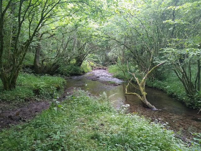
Circular walk encompassing open moors on the Roman Road, valley with fast flowing stream, ford and woodland.
Drive out of Pickering past the railway station and through Newton-on-Rawcliffe and Stape. Look for a parking area to the left of the road and a signboard with details of the Roman Road on the right. Walk from here to Hunt house and back along Wheeledale Gill and onto the road at the ford.
Directions in the guide books and on the OS map provided in the cottage.
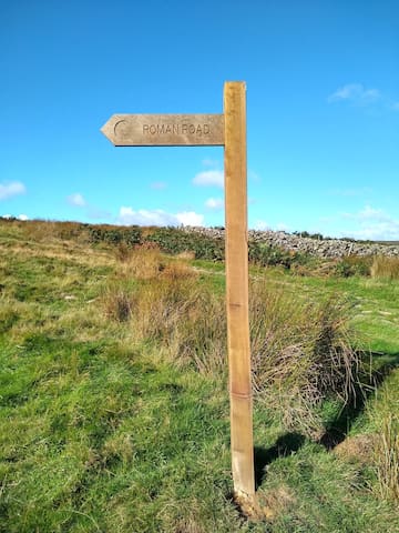
Wheeldale Roman Road
Wheeldale RoadCircular walk encompassing open moors on the Roman Road, valley with fast flowing stream, ford and woodland.
Drive out of Pickering past the railway station and through Newton-on-Rawcliffe and Stape. Look for a parking area to the left of the road and a signboard with details of the Roman Road on the right. Walk from here to Hunt house and back along Wheeledale Gill and onto the road at the ford.
Directions in the guide books and on the OS map provided in the cottage.